


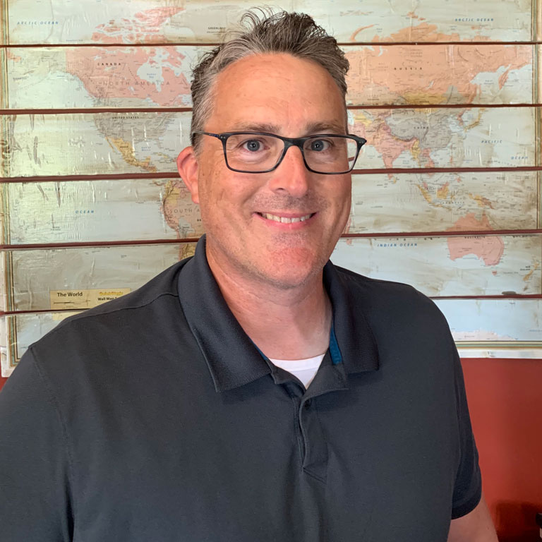
We're launching Polis Profiles, a new Q&A series highlighting the people behind The Polis Center's work and the ideas, research, and partnerships that further our impact.
For our first feature, we're talking with IU Indianapolis Associate Professor of Geography Daniel P. Johnson. Dan was appointed The Polis Center’s co-director and director of academic research on June 1 for a two-year term. A nationally recognized researcher, Dan's work focuses on the intersection of spatial epidemiology, environmental health, climate resilience, and geospatial technologies, including remote sensing and GeoAI. He has led and contributed to federally funded research projects with the National Institutes of Health (NIH), NASA, and the Centers for Disease Control and Prevention (CDC).
Dan's appointment supports a key goal in The Polis Center's strategic plan: expanding the center's academic reach and visibility across the university as well as strengthening our interdisciplinary collaboration while maintaining our longstanding commitment to community-engaged work.
Read on to learn more about Dan, his vision for this new role, and how it will help advance The Polis Center's mission.
POLIS: What drew you to the field of geography, and how did you get started?
JOHNSON: What hooked me was the realization that place is not just a backdrop for health; it is a driver of it. Two people in the same city, less than a mile apart, can face meaningfully different environmental risks, and geography gives you the tools to measure that difference rather than just assert it. I came to the field through a professor who highlighted the interdisciplinary nature of geography (coming from majoring in geology and physics), and I have spent my career at the intersection of spatial statistics, environmental science, and public health ever since. My early work on extreme heat vulnerability, mapping which neighborhoods bear the greatest risk during heat events, set the trajectory: rigorous spatial methods in service of questions that matter to real communities.
POLIS: You recently completed a sabbatical. What topics did you explore, and how are you incorporating your findings into your research and scholarly work?
JOHNSON: My sabbatical focused on geospatial artificial intelligence, specifically how the new generation of Earth observation foundation models can be combined with classical spatial statistics to produce neighborhood-scale environmental health intelligence. I built analytical pipelines addressing extreme heat and other climate hazards, submitted two proposals to external agencies, and secured an internal IU seed grant to continue the work. I also began conversations with FEMA and the CDC about applying AI-based methods to strengthen national tools like the National Risk Index and the CDC Social Vulnerability Index, a direction I intend to keep developing. That research now runs through everything I am doing: papers currently under review on calibrated uncertainty for these models, a sole-authored textbook under contract with Wiley-IEEE Press on the statistical foundations of GeoAI, and, directly relevant here, the methods I plan to bring into The Polis Center’s data infrastructure.
POLIS: How do you see your research interests aligning with The Polis Center's mission and work?
JOHNSON: The alignment is almost one-to-one. Polis exists to turn data into insight that communities and institutions can act on, and that is a fair description of my entire research program. My work takes satellite observations and administrative health data and translates them into fine-grained, neighborhood-level understanding of environmental risk, whether that is heat exposure, flooding, or disease patterns. SAVI is one of the most valuable community information systems in the country precisely because of its local depth: Marion County administrative data, state health records, 211 calls, clinical linkages. My research asks what more we can learn from exactly those kinds of data when we bring modern spatial methods to them. Polis has the data and the community trust; I bring the methodological toolkit. That is a natural partnership.
POLIS: What opportunities do you see for expanding research and collaboration through The Polis Center?
JOHNSON: The strategic opportunity is building a genuine academic research pipeline on top of the community-facing work Polis already does well, so the same trusted data infrastructure serves both audiences without compromising either. Concretely, that means a faculty fellows program that draws researchers from across campus into collaborative projects using SAVI data, deeper integration with clinical data partners like the Regenstrief Institute, and positioning Polis as the local data backbone for federally funded research on climate and health. Indianapolis is an ideal laboratory for questions the whole country is asking about extreme weather, health equity, and aging communities. Polis can be the place where those questions get answered with local data and national-caliber methods.
POLIS: What are you looking forward to doing in this role at The Polis Center?
JOHNSON: Honestly, working with people. I have spent much of my career as a fairly independent researcher, and what excites me about this role is building something collaborative and durable: a research community around Polis that outlasts any single grant or project. In the near term, that means launching the faculty fellows program and strengthening SAVI's academic side. Over the longer arc, I want Polis to be recognized nationally as a model for how a university center can serve its community and produce first-rate scholarship at the same time. Those two goals are usually framed as a tradeoff. I do not think they have to be.
POLIS: What advice do you have for students interested in your field?
JOHNSON: Learn the foundations, not just the tools. Software and AI models change every eighteen months; the statistical and spatial thinking underneath them does not. A student who understands why spatial data behave the way they do will still be valuable when today’s platforms are obsolete. Second, anchor your work in a real problem. Methods developed in a vacuum tend to stay there. Find a question you actually care about, whether it is heat, housing, or health, and let the problem discipline your choice of methods. And third, geography is a team sport at its best. Seek out collaborators from other fields early; the most interesting work happens at the boundaries.
POLIS: What else would you like to share?
JOHNSON: I would just add that this is an unusually good moment for this kind of work. The convergence of Earth observation, AI, and community data systems means questions we could only gesture at a decade ago are now answerable at the neighborhood scale. We can now estimate heat exposure, flood risk, and health vulnerability block by block rather than settling for county averages, and that precision changes what cities and health systems can actually do with the information. The same shift is happening at the federal level, where agencies like FEMA and the CDC are rethinking how their national risk and vulnerability tools are built, and I want the work we do here to inform that conversation. Indianapolis, through Polis and its partners, is better positioned than almost any city I know to lead on it. The data infrastructure exists, the institutional relationships exist, and the community need is real. I am glad to be part of it, and I would encourage anyone on campus with a spatial question, whether they think of it that way or not, to be in touch.
